For nearly 40 years, environmental groups, parks planners and other outdoor lovers have worked to piece together a breathtaking vision: Building a continuous 550-mile trail around the Bay Area’s ridgelines for hikers, bicyclists and horse riders to get out of traffic, step away from computer screens and enjoy the outdoors.
Marked with blue signs, the Bay Area Ridge Trail takes in stunning views of the Golden Gate Bridge from the Marin Headlands; San Mateo County forests above Crystal Springs Reservoir; bucolic former ranch lands on the slopes of Mount Hamilton; and the necklace of East Bay parks from Mission Peak to the Carquinez Strait.
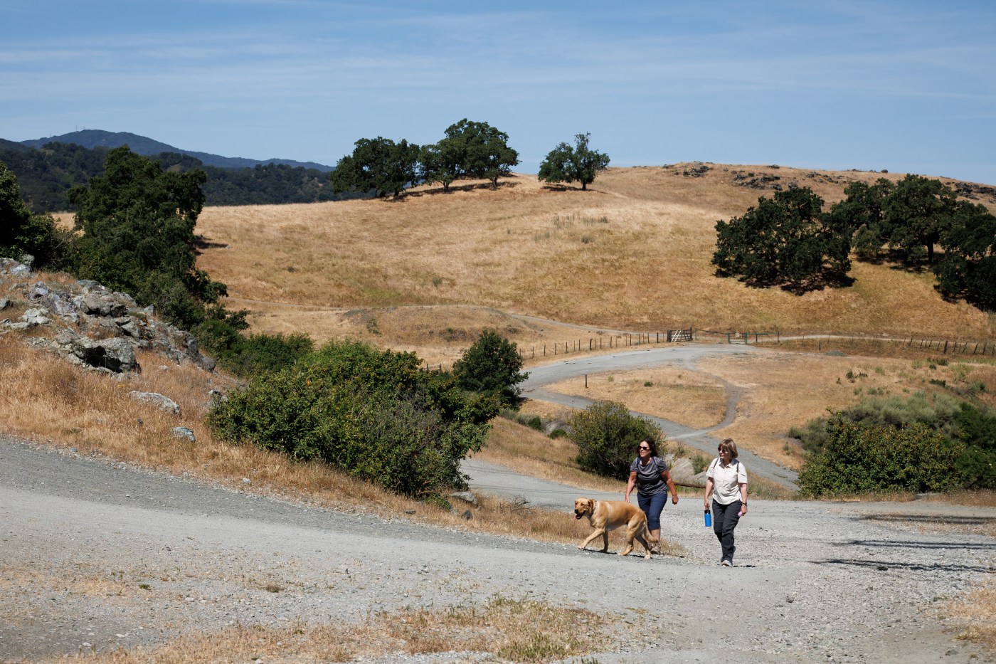
Now the project is receiving a significant boost this month as a new 14.1-mile section is added on San Jose’s southern edges, which will bring the total to 427 miles — about three-quarters done.
“Fourteen miles is a big stretch,” said Janet McBride, executive director of the Bay Area Ridge Trail Council, a Berkeley non-profit group spearheading the project. “The Bay Area is spectacularly beautiful. The trail is a thread that connects all nine counties. It supports wildlife habitat and recreation. It improves our health, our well being, and provides inspiration.”
The new 14.1 miles is already open to the public for hiking, bicycling, and horse riding. It runs from the Rancho San Vicente trailhead of Calero County Park in South San Jose to the Rancho Cañada del Oro Open Space Preserve in the meadows and rolling foothills between Los Gatos and Morgan Hill.
A public dedication is planned for 10 a.m. on May 31 at the Rancho San Vicente trailhead.
The new stretch of trail — which is open from sunrise to sunset — didn’t involve recent construction.
Rather, it was the result of a plan by the Bay Area Ridge Trail Council, and government agencies like the Santa Clara County Parks and Recreation Department and the Santa Clara Valley Open Space Authority, to reroute the larger Bay Area Ridge Trail away from its original planned route.
The original route included a stretch along Summit Road on the Santa Cruz-Santa Clara County border. But that area contains few parks, dozens of private properties with owners who haven’t wanted to sell their land or trail easements, and residents who have been known for decades for putting up no-trespassing signs along road.
“It was just stuck,” McBride said. “The route along Summit Road wasn’t going anywhere. It was extremely difficult. So we changed plans.”
Instead planners rerouted 33 miles to the east to better connect Almaden Quicksilver County Park and Mount Madonna County Park near Gilroy.
Bay Area Ridge Trail Council Executive Director Janet McBride talks during an interview at the Lisa Killough Trail at Calero County Park, which will become part of the Bay Area Ridge Trail that spans all nine Bay Area counties, on May 15, 2025, in San Jose, Calif. (Dai Sugano/Bay Area News Group)
That kind of flexibility has been key to keeping momentum going over the years.
“It’s the reality,” said Bob Doyle, retired general manager of the East Bay Regional Park District in Oakland. “If you can’t go somewhere because somebody sued somebody, or they built a freeway, the goal is to connect it in the most scenic corridors. In some cases you move the route. That helps drive the vision to reality so it doesn’t stall.”
There are famous hiking trails across the United States — from the 2,650 mile-long Pacific Crest Trail, which traverses the Sierra and Cascade mountains of California, Oregon, and Washington, to the Empire State Trail, which runs 750 miles from downtown Manhattan to the Canadian border.
But the Bay Area Ridge Trail is unique. A loop overlooking a region of 8 million people, passing through forests, meadows and mountaintops, all within a short walk, drive, or bike ride from cities. The idea was born in the dreams of a few hardy hikers. But it took William Penn Mott Jr., a former general manager of the East Bay Regional Park District, to make it happen. In 1987, Mott, as President Ronald Reagan’s national parks director, provided advice and funding to help organize the trail.
“It was an incredible vision,” said Doyle, who was friends with Mott until his death in 1992. “He knew it would take a long time. But it takes a long time to do great things. He would be very pleased now. He would be clapping.”
After the first mile was dedicated in 1989 in San Mateo County at Purisima Creek Redwoods Preserve and Huddart County Park, the trail grew quickly at first. It reached 100 miles within one year as existing trails in parks were connected. It took another 5 years to get to 200 miles, then another 10 years to get 300 by 2006.
McBride estimated it will take another 20 years to get to 550 miles.
Although there are long unbroken stretches in the Peninsula and East Bay, the route in the North Bay through Napa and Sonoma wineries has been slow to complete. And it had been slow in Santa Clara County, until a boom in recent years of parks agencies and land trusts buying ranches and other property around Coyote Valley and other open areas.
“Just get out on a piece of the trail,” said Dan Allison, 73, from Sacramento, who has hiked 400 miles of it twice in the past three years. “You can go out for a day hike, and if you enjoy that you can start backpacking. I run into people who live in the Bay Area who aren’t even aware of all the parks. It’s amazing to have that much public land in such an urban area.”
On a recent Thursday morning the new 14.1-mile stretch of trail had regular cyclists, hikers and dog walkers taking in views of Mount Hamilton to the east and Mount Umunhum to the west, a mosaic of oaks and orange poppies.
“I’m from the Midwest where there’s lots of open space,” said cyclist Mike Peterson, of San Jose. “I also lived in Salt Lake City and used to ski after work. When I moved here, I wasn’t expecting it to be that outdoorsy. Getting out here is good for your mental health. You can blow off some steam out there on the trail.”
A bicyclist rides on the Lisa Killough Trail at Calero County Park, which will become part of the Bay Area Ridge Trail that spans all nine Bay Area counties, on May 15, 2025, in San Jose, Calif. (Dai Sugano/Bay Area News Group)


