Amid hot, dry weather in Northern California, a lightning-sparked fire near Shasta Lake has grown to almost 12,000 acres.
Related Articles
Esparto fireworks explosion: East Bay brothers identified as two of seven victims
Elias: Bay Area’s Garamendi saying insurance czar ‘should go’ unheard of
Bay Area Air District issues advisory for wildfire smoke
Cal Fire rolled out an AI chatbot. Don’t ask it about evacuation orders
13-year-old suspected of setting off fireworks that sparked California wildfire
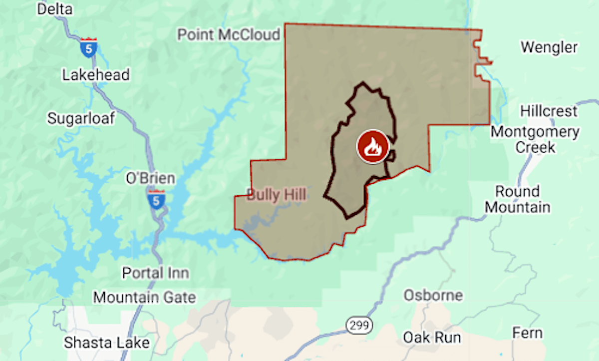
The Green Fire started July 1 along the lake’s Pit River arm. Evacuations were ordered Friday, July 11, for about 110 square miles of sparsely populated national forest in Shasta County.
As of Monday, July 14, the fire was estimated at 11,766 acres (18 square miles) by the California Department of Forestry and Fire Protection. The map above shows the evacuation area in red and the approximate fire perimeter as a black line.
Shasta Lake remained open for recreation; boaters were warned to stay out of the way of firefighting aircraft scooping water from the reservoir.
Air quality from Shasta Lake to Redding and Anderson was deemed hazardous Monday morning but was expected to improve in the evening, said the U.S. Interagency Wildland Fire Air Quality Response Program. On Redding’s east side and in nearby communities, the air quality index Monday ranged from 400 to more than 1,500, and residents were advised to stay inside.
A heat advisory was in effect for the area through 11 p.m. Monday with high temperatures of 95 to 110 expected in the northern Sacramento Valley, the National Weather Service said.
Green is California’s fourth-largest wildfire of the year, after Madre, which burned 80,000 acres this month in Central California, and Los Angeles County’s Palisades and Eaton fires in January.
Also in Northern California, evacuations have been ordered for the Orleans Complex, which has burned 7,319 acres in Siskiyou and Del Norte counties.