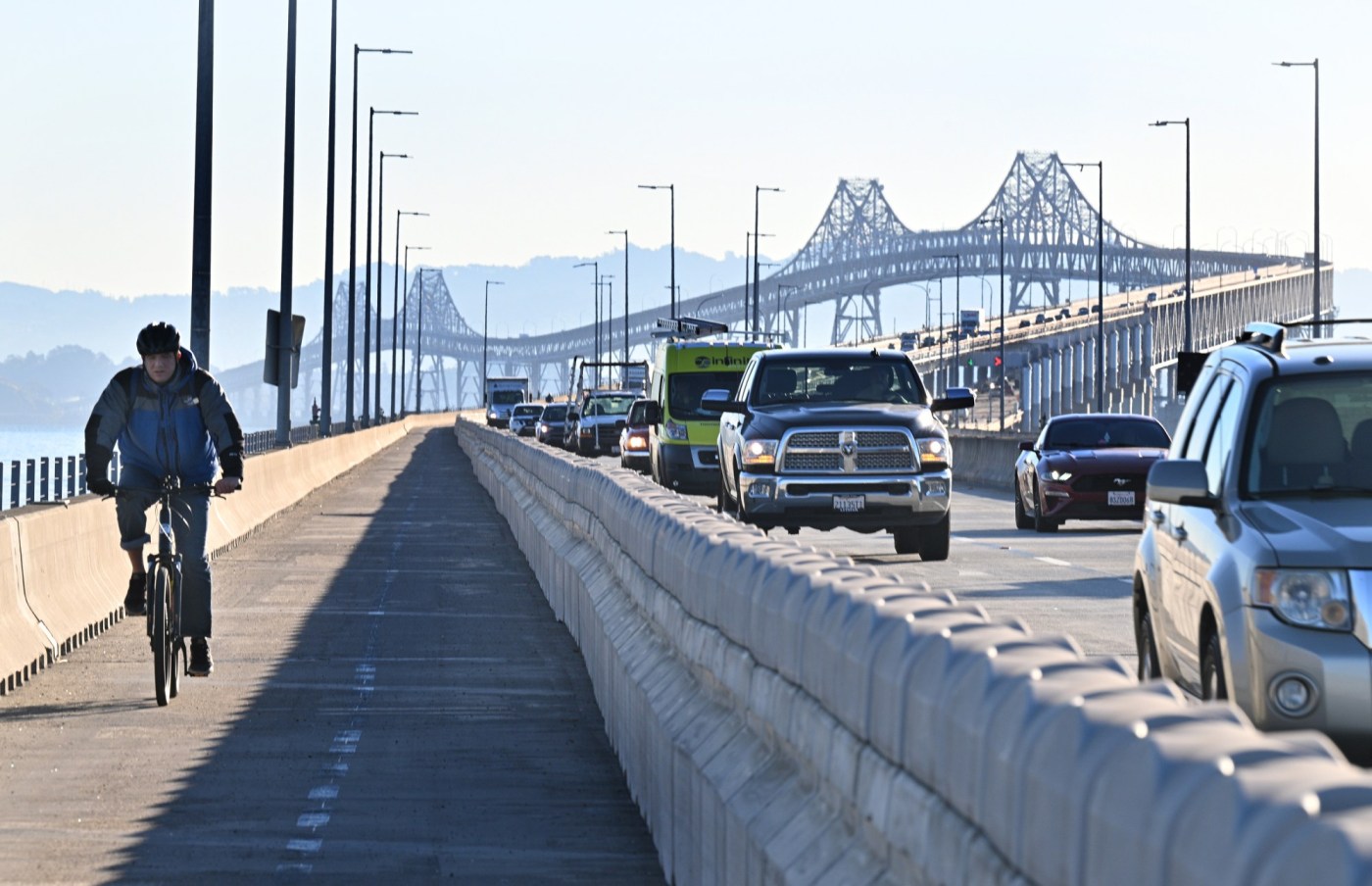
A revised proposal to convert the Richmond-San Rafael Bridge bike path to a part-time feature is under review.
Caltrans, which owns the bridge, and the Bay Area Toll Authority, which funds operations and maintenance of the span through toll revenue, submitted its revised application on Monday.
RELATED: East Bay official wants new Richmond-San Rafael Bridge
“The modified pilot is a forward-thinking approach that will benefit all corridor travelers,” the application said. “In conjunction with the complementary projects and studies, it will allow Caltrans and BATA to methodically understand the trade-offs through observed data and better serve the varied users traveling between Contra Costa and Marin counties.”
Related Articles
Bay Area high school cycling coach dies after bike crash
Los Altos bans bicycles and e-bikes from its sidewalks
What’s with the endless construction ripping up Uptown Oakland’s streets?
What are California’s rules about kids on electric bikes?
Letters: National Guard deployment in Los Angeles threatens rights of all
The San Francisco Bay Conservation and Development Commission, or BCDC, plans to hold a public hearing and possible vote on the proposal on Aug. 7, said Rylan Gervase, a spokesperson for the agency.
The barrier-protected, 10-foot, bidirectional path was introduced in 2019 as a four-year pilot project. Since its opening, the path has served as a success story for cyclists promoting access and connectivity, while commuting drivers complain that bridge traffic is worse than ever.
Last year, BATA and Caltrans proposed reopening the lane for emergency vehicles and breakdowns during weekdays, and then restoring the path on weekends in an attempt to strike a balance. The agencies submitted an initial application for the modification last summer, but disagreement over the plan led to delays.
“There has been quite a bit of activity and discussion since then, and ultimately, identifying opportunities for BATA and Caltrans to strengthen the application,” Lisa Klein, deputy director of the Metropolitan Transportation Commission and Bay Area Toll Authority, said at an oversight committee meeting on Wednesday.
The application proposes that the path be available from 2 p.m. Thursdays to 11 p.m. Sundays. The barrier would be pushed to the side so the shoulder could be used as an emergency breakdown lane the rest of the time. A bike shuttle would operate from 6 a.m. to 8 p.m. when the path is closed.
If approved, the extended pilot would continue for three years beginning this fall.
At the same time, Caltrans and BATA are committed to advancing a suite of projects to improve traffic across the span, including open-road tolling, the application said.
The application also incorporates the agencies’ pursuit of a part-time westbound carpool lane. Staff are beginning an environmental review of what would be required to accommodate a third lane on the upper deck.
Early estimates show it would cost $14 million to $45 million alone for construction. Those estimates do not account for any potential environmental mitigation or structural strengthening that might be needed.
Results of the analysis are expected to be completed in 2028 and will inform the next steps for the upper deck, according to the application.
Rollie Katz, executive director of the Marin Association of Public Employees, the union that represents the majority of the county’s employees, including the lowest-paid workers, has been advocating for the lane to be reopened to vehicles.
Katz said more than half of the association’s members do not live in Marin, and many commute from Alameda and Contra Costa counties.
Katz said converting the lane back to a breakdown lane Monday through Friday would be better for drivers and would have little impact on cyclists since path counts suggest it gets the greatest use on weekends.
“That said, the Caltrans/BATA application is what is before us,” he said. “We support it. We believe it is more than reasonable.”
Katz said the union is encouraged by the plan to pursue the addition of a westbound carpool lane.
“That process should happen as quickly as possible,” Katz said. “Common sense tells us that opening the lane to buses and carpools will improve traffic flow.”
On Wednesday, the Bay Area Toll Authority oversight committee approved several items related to the bridge as part of the consent agenda with no discussion.
One item authorized increasing a contract by $750,000 to a new total of $1.25 million to relocate overhead utilities along Francisco Boulevard in San Rafael to make way for a bidirectional bike and pedestrian connection to the bridge.
The project widens the sidewalk and adds a path at the bridge touchdown between Main Street and the Sir Francis Drake Boulevard flyover. Work has been delayed due to the discovery of unknown utilities owned by third parties, including San Rafael. The project is now expected to be completed in 2026.
Also approved was $200,000 for on-call design services with HNTB Corp., which has offices in Oakland and San Jose, to produce the project documentation required to implement the modified bike path pilot extension for three years. The amendment also supports design services through completion of the path project on Francisco Boulevard. The amendment brings the contract total to $16.6 million.
The oversight committee also approved a contract worth $1.6 million with Code 3 Transportation to provide the shuttle service for cyclists during the extended three-year pilot period.
Members of the Marin County Bicycle Coalition have been remaining committed to maintaining 24/7 access to the multiuse path on the bridge.
“We would rather they keep their $1.6m and keep the trail open,” Tarrell Kullaway, the organization’s director, said in an email.
“We do not believe that the things the trail pilot was supposed to test have been tested yet,” Kullaway said. “In particular, the toll plaza, where the biggest bottleneck occurs, and the lack of safe connections on the Marin side should be addressed before data can be deemed accurate.”
Kullaway also noted that the path from Main Street to Sir Francis Drake Boulevard in San Rafael is incomplete, making access to and from the bridge on the Marin side challenging for some.
“It is extremely hasty to judge the success of the trail under these conditions,” Kullaway said.