The Green Fire, burning near Shasta Lake, is now California’s third-biggest wildfire of the year, the Department of Forestry and Fire Protection said.
Related Articles
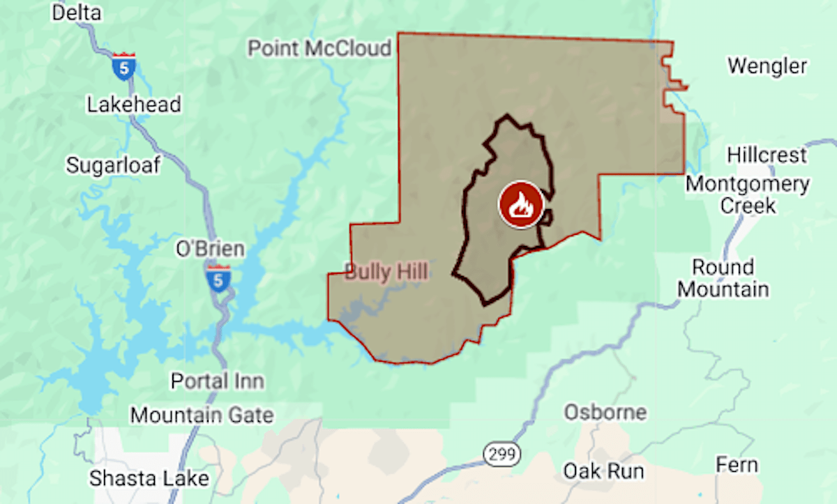
Map: Green Fire sends heavy smoke over Redding
Esparto fireworks explosion: East Bay brothers identified as two of seven victims
Elias: Bay Area’s Garamendi saying insurance czar ‘should go’ unheard of
Bay Area Air District issues advisory for wildfire smoke
Cal Fire rolled out an AI chatbot. Don’t ask it about evacuation orders
Estimated by Cal Fire at 14,181 acres (22 square miles) on Tuesday, July 15, Green passed January’s Eaton Fire, in Los Angeles County. Ahead of it on this year’s list are Madre (80,786 acres in San Luis Obispo County) and Palisades (23,448 acres, Los Angeles County).
The Green Fire was started by lightning July 1 near Shasta Lake’s Pit River arm. Evacuations that were ordered Friday, July 11, remain in effect for about 110 square miles of sparsely populated national forest in Shasta County.
The map above shows the evacuation area in red and the approximate fire perimeter as a black line. Containment was at 5% Tuesday. The fire’s north edge abuts the footprint of last November’s Shoe Fire, which burned 5,100 acres.
After a period of unusually hot weather, the Forest Service fire team predicted cooler temperatures and higher humidity starting Tuesday.
Heavy smoke has settled over communities near Shasta Lake and east of Redding, with air quality at levels deemed very unhealthy to hazardous Tuesday morning. Conditions were expected to improve in the late afternoon or evening, the U.S. Interagency Wildland Fire Air Quality Response Program said.
Shasta Lake remained open for recreation; boaters were warned to stay out of the way of firefighting aircraft scooping water from the reservoir.
Also in Northern California, evacuations have been ordered for the Orleans Complex, which has burned 8,272 acres in Siskiyou County.