After the Butler Fire crossed the Salmon River, more evacuations were ordered Thursday night in the mountains of Siskiyou County.
Related Articles
Map: Dale Fire evacuation zone
Map: Butler Fire evacuation zone expanded
Ten acre East Bay fire prompts health advisory for smoke
San Jose firefighters respond to blazes south of Mineta International
Map: Green Fire is now 3rd biggest in California this season
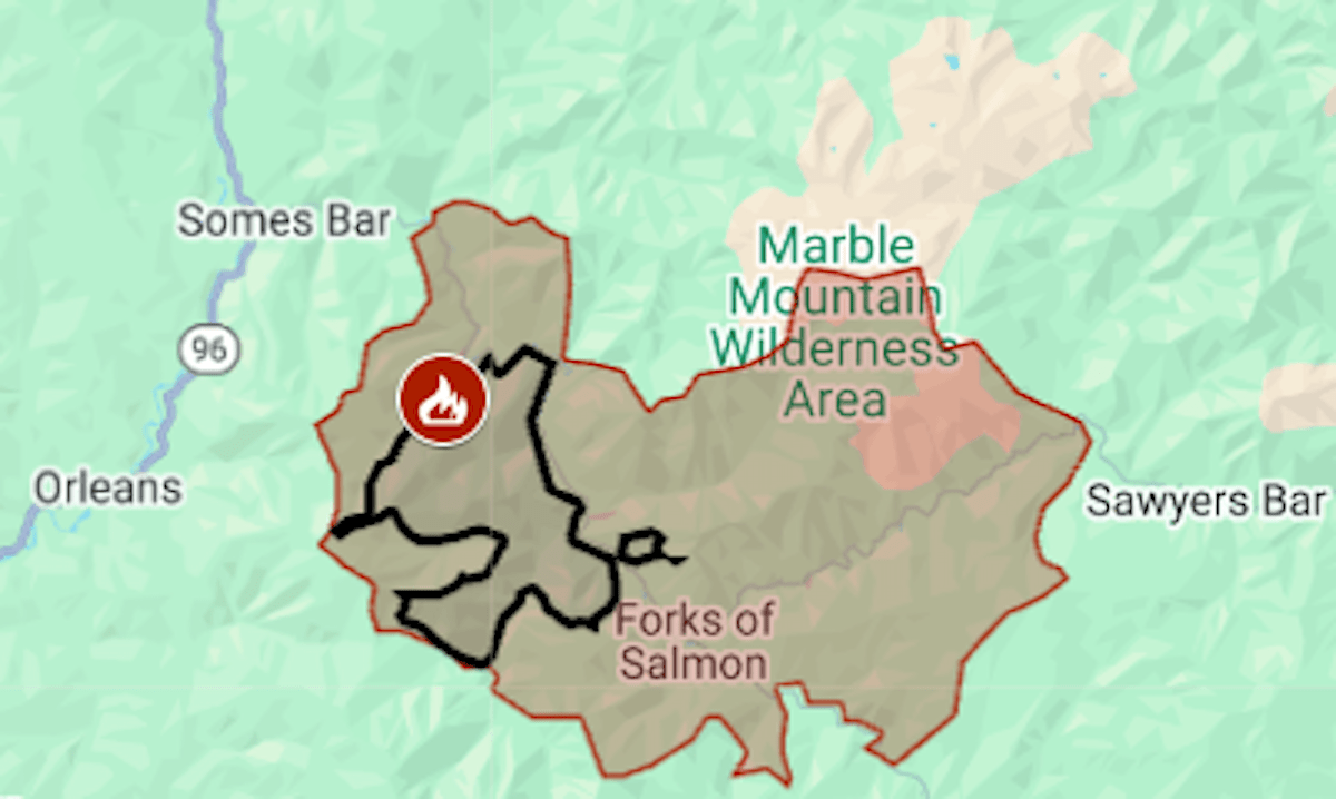
The wildfire, sparked by lightning on July 3, had burned 11,641 acres (18 square miles) and was 2% contained, the California Department of Forestry and Fire Protection said. It is the larger fire in the Orleans Complex.
On Thursday, July 17, a spot fire ignited on the east side of the river, and several hours later the Siskiyou County Sheriff’s Office issued evacuation orders for two more zones. The evacuation area now covers 100 square miles, including the community of Forks of Salmon.
The map above shows the evacuation area in red and the approximate fire perimeter as a black line.
For updates and details of the evacuation, including warning areas, see the Genasys Protect map or the Siskiyou County emergency website.
Evacuation orders have also been issued for the Green Fire, burning since July 1 near Shasta Lake. On Thursday it was estimated at 17,606 acres (27½ square miles), California’s third biggest wildfire of the year.