On the eve of Labor Day weekend, a wildfire has prompted the closure of a popular recreational area in the Sierra National Forest east of Fresno.
Related Articles
Map: Dillon Fire evacuations in Siskiyou County
Congressman Sam Liccardo unveils partnership to bolster wildfire resistance in West Valley
Air attack stifles wildfire in rugged terrain above Corralitos
Local agencies work to spark West Valley residents’ interest in wildfire mitigation
Pickett Fire containment rises to 21% as Napa County issues health emergency over debris
The forest’s managers said public access to areas including Courtright and Wishon reservoirs will be closed starting Thursday, Aug. 28, because of the Garnet Fire.
Those reservoirs fall within the evacuation area declared by Fresno County’s sheriff on Sunday, the day the fire was reported. Despite that order, people said this week on social media that when they called to cancel camping reservations at Wishon Reservoir, staffers told them that they would not get a full refund because the Forest Service had not declared an evacuation.
A statement Wednesday from Sierra National Forest said its partial closure is set to expire Sept. 16. “Wherever practical, identifiable sections will be ‘carved out’ and taken off the order as soon as possible,” it said.
Garnet, one of a spate of California wildfires thought to have been sparked by lightning over the weekend, had burned 13,934 acres (22 square miles) by Thursday, the national forest’s fire managers said. It is California’s fifth-largest fire of the summer.
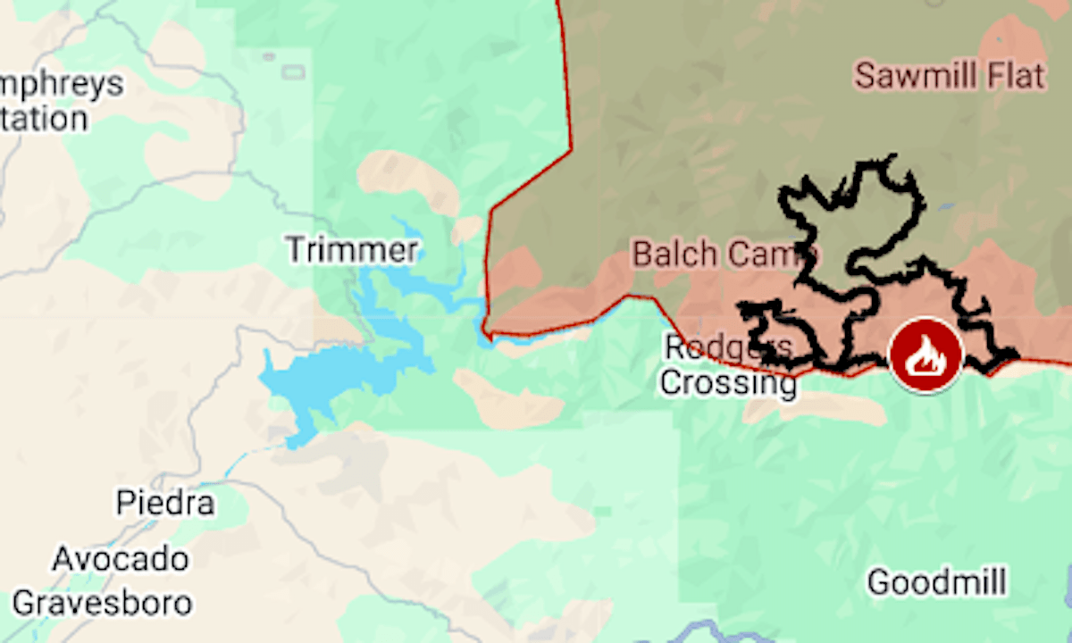
The evacuation order covers almost 300 square miles of the national forest in Fresno County, extending to the east shore of Pine Flat Lake.
The map above shows the evacuation area in red and the approximate fire perimeter as a black line. Updates and details, including evacuation warning zones, can be found at Fresno County’s emergency website.