Residents of the Sierra Nevada foothills in southern El Dorado County have been put on warning because of a wildfire burning near the footprint of the devastating 2021 Caldor Fire.
Related Articles
Saratoga’s FireSafe Council gets $185k grant for wildfire resilience projects
Man gets 73 years for murders, arson that sparked deadly Bay Area wildfire
Elias: Playing fireman, Trump has actually increased California’s fire risk
Map: Shelter-in-place lifted for King Fire on I-5 Grapevine
Long-shot ballot initiative could have huge effect on California insurance
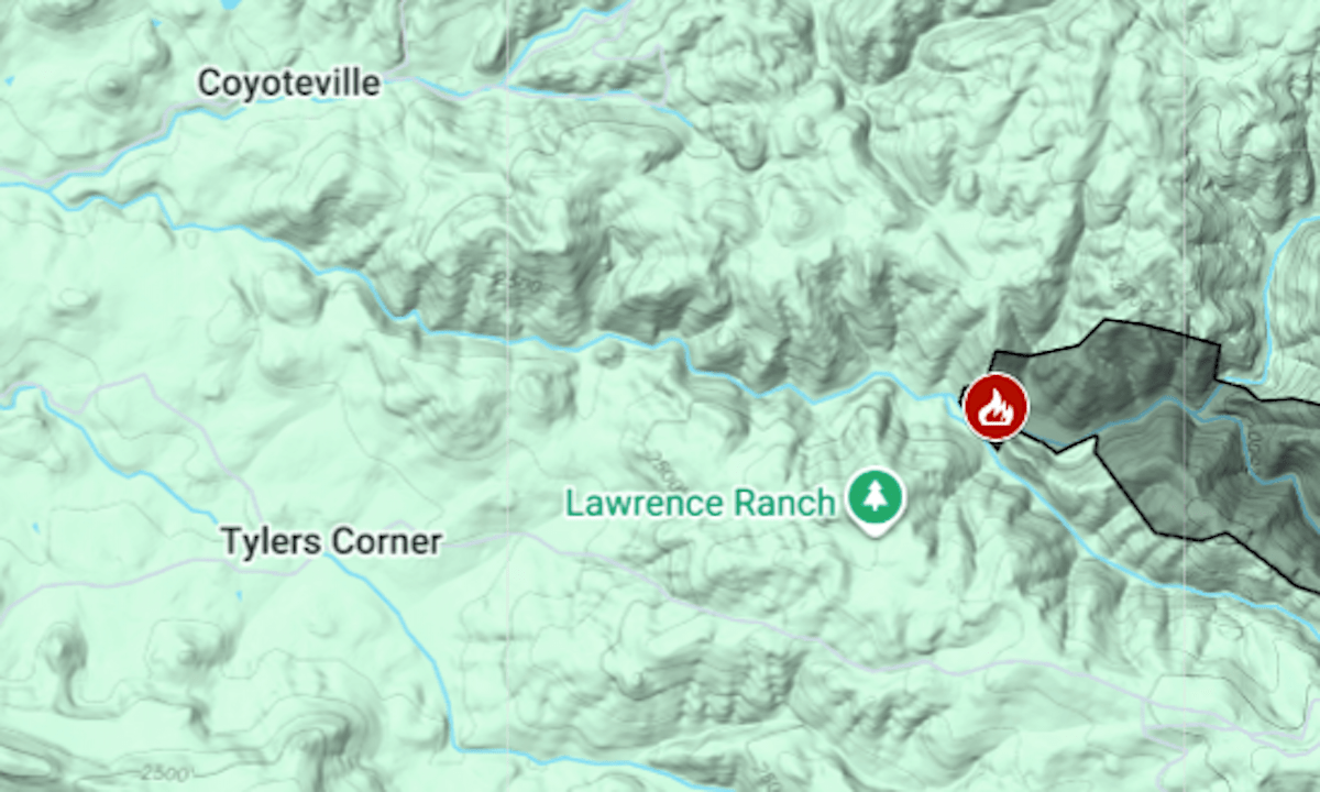
The Coyote Fire was reported around 2 p.m. Wednesday, Aug. 20, about 6 miles north of Volcano. By Thursday morning, it had burned 624 acres, the California Department of Forestry and Fire Protection said.
An evacuation warning remained in place Thursday for a 35-square-mile area east of Coyoteville, from Omo Ranch to Farnham Ridge Road, the El Dorado County sheriff’s office said. Boundaries of that zone can be found on the county’s emergency map platform, Perimeter. There was no evacuation warning in Amador County, on the other side of the South Fork Cosumnes River.
Caldor, California’s third-biggest wildfire of 2021, began on Aug. 14 of that year just east of Omo Ranch; it burned 221,835 acres (346 square miles) and forced evacuations in South Lake Tahoe. A father and son were accused of sparking it by firing guns, but a judge ruled there was not sufficient evidence to try them on charges of reckless arson.