Heavy rain Thursday caused mudslides, debris flows and flooding in Southern California.
Related Articles
Grammy-winning songwriter Brett James who co-wrote ‘Jesus, Take the Wheel’ dies in plane crash
Man dies from ‘blunt impact’ after riding Epic Universe’s Stardust Racers
AI cameras are spotting wildfires across California — often before humans call 911
Caltrans engineer dies after being struck by asphalt truck in East Bay
One killed, another injured in solo-vehicle crash in San Jose
Some mountain communities in San Bernardino County recorded more than 1½ inches in an hour as the thunderstorms moved through.
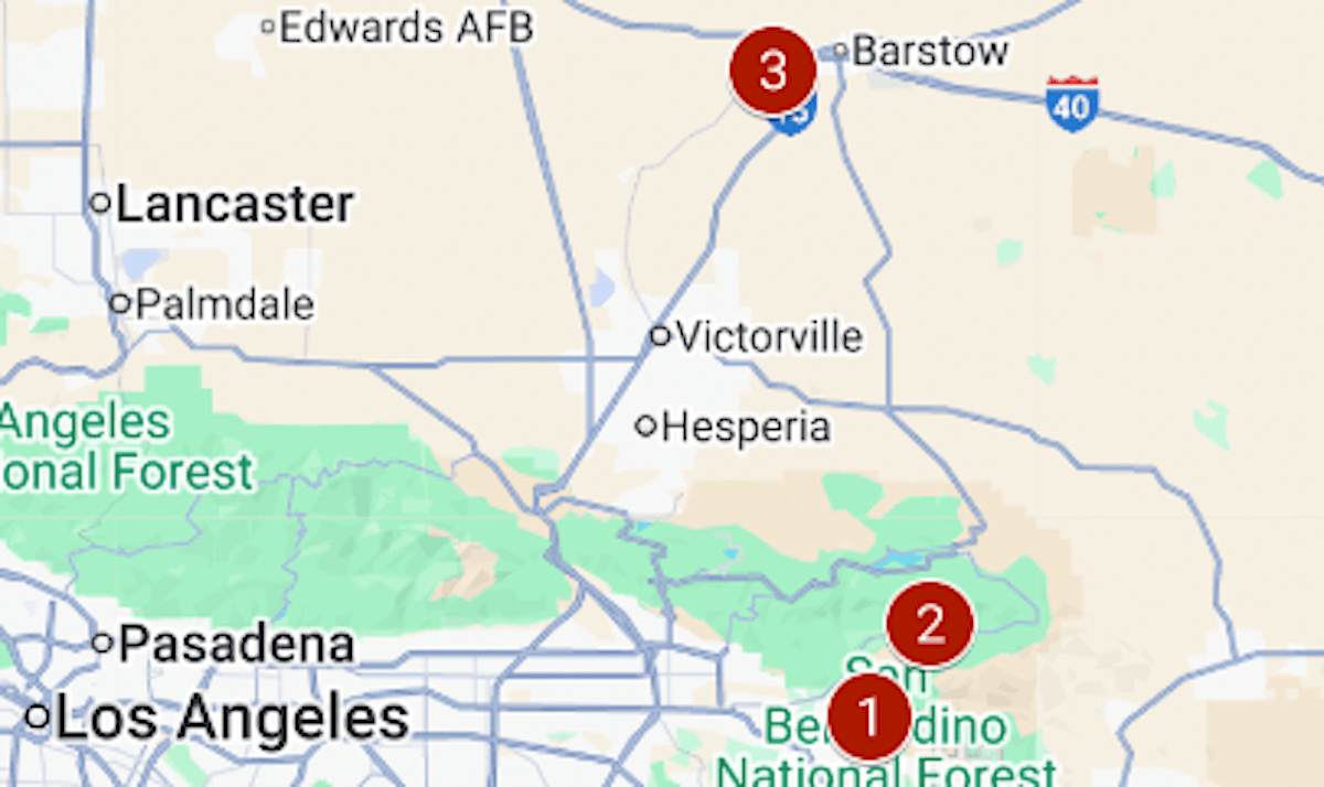
The map above shows sites that were particularly hard-hit.
1/ Oak Glen & Potato Canyon. Multiple homes were damaged and roads closed by mudflows. The area is prone to erosion as it recovers from the 2020 El Dorado wildfire.
2/ Highway 38. Thirty miles of the road, from Forest Falls to just south of Big Bear, remained closed Friday because of mudslides, the California Department of Transportation said. About 10 people were stranded for hours in their cars when the road became impassable in both directions near Jenks Lake, the San Bernardino County sheriff’s office said.
3/ Barstow. A search is on for a 2-year-old boy who was swept away by floodwaters as his father tried to carry him to safety from their stranded car.
4/ Death Valley. Flooding and debris closed some roads in the national park as it recorded half an inch of rain — about a quarter of its yearly average.